Introduction
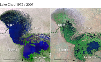
Twenty-first century cities have embraced new technologies to automate everything from waste management, power supply, water treatment, transportation to all other service delivery that makes a liveable city. Despite all these, city residents face security challenges on daily basis due to failures of traditional security apparatus. Crime has consistently been on the rise while its dimension is following octopus shape and style. Crime ranges from theft, organized robbery, assassination, kidnapping to terrorism has become part of Nigeria’s urbanization process. This has stretched the security apparatus to the limit. This problem led to the evaluation of the critical infrastructure protection in the United States in 1996. The outcome of this effort recognized the need for the establishment of important framework for understanding and mitigating threats to security with advance technology. It is observed that the economic prosperity, military strength, political vitality, creation of wealth for the Nation and high quality of life as a people all depend on the continuous functioning of the nation’s critical infrastructures. In Nigeria, the North-East region is suffering from over one decade of Boko Haram insurgency that devastated the economic potentials of the region, which saw a drastic decline in Internally Generated Revenue (IGR), low school enrolment, decline in access to health care facilities and natural resources, and deteriorating transportation network and other critical infrastructure. The Boko Haram insurgency began in July 2009, when the Jihadist group Boko Haram started an armed rebellion against the government of Nigeria. After years of fighting, the insurgents became increasingly aggressive and started to seize large areas of North-eastern Nigeria. But prior to the Boko Haram insurgency, there was free flow of movement of people and goods, Page 8 | 26 underscoring inter-state and trans-border mobility in the North-east region and the neighbouring countries of Niger Republic, Chad and Cameroon. Insurgents’ attacks disrupted such flows, transforming inter-state and trans-border routes into highways of terror and destruction. Insurgents targeted attacks at motorists, commuters, security personnel, ordinary people and critical infrastructure. The use of space technology for mapping activities has over the years gained prominence in the developed and developing countries of the world. This is because it has proved to alleviate the tedious tasks of conventional survey approach, accessibility to remote areas, as well as having the synoptic view of settlements. This project identified critical infrastructure in the North-East region, mapped hotspot’s locations of these critical infrastructure and developed a user interface that automatically generate hotspots when new data/information is added to the database.