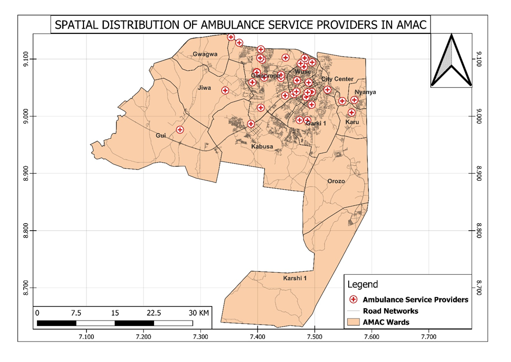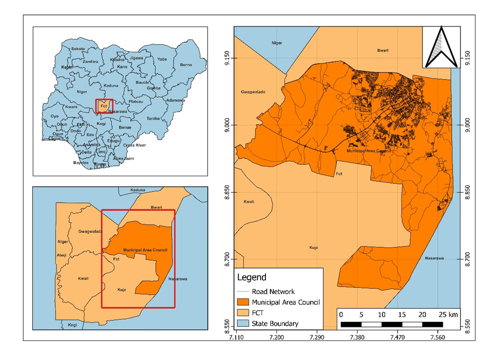
Ambulances are one of the modes of transportation used to provide medical assistance to victims of emergencies. The present study was aimed at assessing the emergency response travel time of ambulances for medical emergencies in Abuja Municipal Area Council of Abuja, Nigeria based on provided services in terms of time parameters. This was achieved by integrating Geographic Information System (GIS)-based network analysis. The datasets utilized for this research were obtained from the Geo-Referenced Infrastructure and Demographic Data for Development (GRID3) portal and National Emergency Medical Services and Ambulance Scheme (NEMSAS). The results showed that the ambulance service providers in Abuja Municipal Council area are mostly located in the urban part of the city, leaving the suburban settlements underserviced. Recommendation suggests that the FRSC should locate more ambulance centres in the underserved areas.
RESULTS